Lot · North America Maps
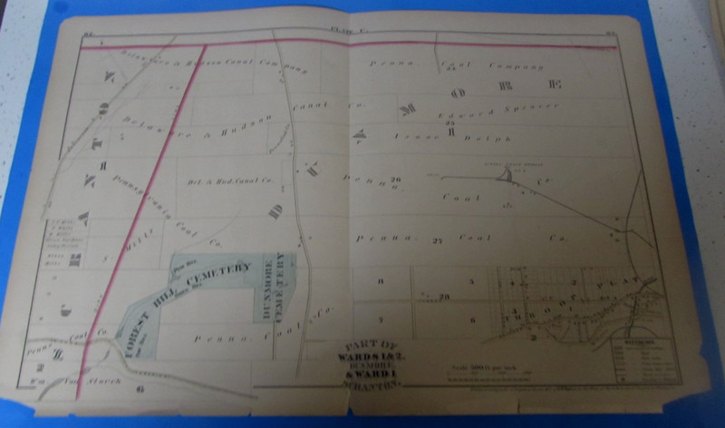
ORIGINAL 1877 DUNMORE (WARDS 1&2) / SCRANTON WARD 1 - PLATE (MAP) - VERY GOOD
 Archived listing photo
Auction ended
Final result not shown
Closed
Sat · Jul 18, 2026
Auction window
See it on eBay
Past North America Maps auctions
This auction has ended. The link opens the listing on eBay, where the seller may relist or offer similar items.
Ships from
ZIP 185**
kosloski2005
14,347 ratings · 100.00% positive
Description
From the sellerYou are bidding on original antique map of Dunmore WARDS 1 & 2 and WARD 1 Scranton Pa. This map includes from The Forest Hill Cemetery, Some Penna. Coal Co. Lands, the Drinker Turnpike and Throop Plat along the bottom. Then some land owned by The Delaware & Hudson Canal Company & Land owned by The Penna. Coal Company on the top. Also on the map is the Gipsey Grove Breaker No. 3 The map measures 26 inches by 17-1/2 inches. It was published by C.M. Hopkins in 1877 as plate "U" of the "City Atlas of Scranton Pennsylvania. Fantastic piece of local history. Would look great framed.
Description is reproduced verbatim from the eBay listing. NightBids does not edit seller copy — refer to the live listing for authoritative details, shipping rates and return policy.