Lot · Maritime Navigational Charts
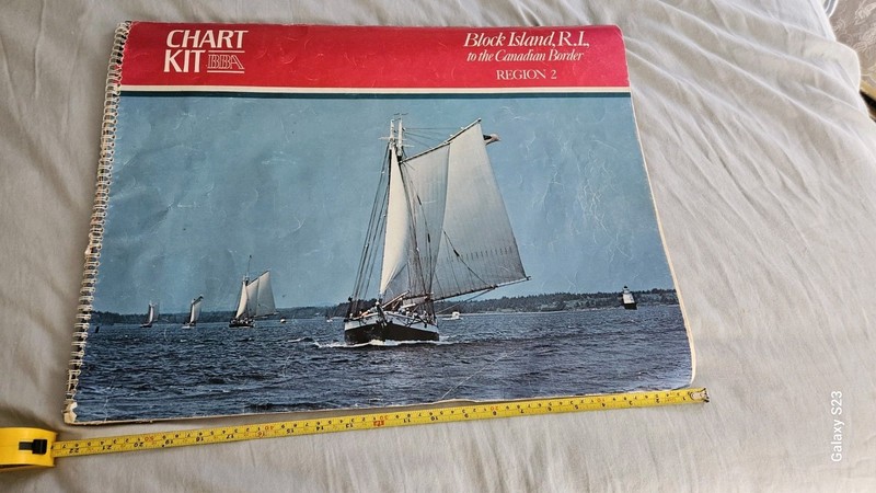
Chart Kit BBA Block Island R.I. to Canadian Border Region 2 Early 1980 22" x 17"
 Archived listing photo
Auction ended
Final result not shown
Closed
Thu · Jul 2, 2026
Auction window
See it on eBay
Past Maritime Navigational Charts auctions
This auction has ended. The link opens the listing on eBay, where the seller may relist or offer similar items.
Ships from
ZIP 040**
bluegil1
9,992 ratings · 100.00% positive
Description
From the sellerThe Chart Kit BBA Block Island R.I. to Canadian Border Region 2 from the early 1980s measures 22" x 17". It is a valuable antique maritime navigational chart that provides detailed information on the coastal region from Block Island, Rhode Island to the Canadian border. This chart would have been essential for sailors and mariners navigating the treacherous waters of this area during that time period. Its historical significance and practical use make it a sought-after item for maritime enthusiasts and collectors alike. Cover torn some on front top and back top. Charts ok.
Description is reproduced verbatim from the eBay listing. NightBids does not edit seller copy — refer to the live listing for authoritative details, shipping rates and return policy.