Lot · Central America/Caribbean Maps
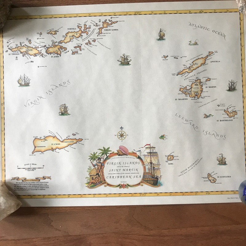
1992 EXACT MAP OF THE VIRGIN AND LEEWARD ISLANDS IN THE CARIBBEAN-NEW In Tube
 Archived listing photo
Auction ended
Final result not shown
Closed
Mon · May 11, 2026
Auction window
See it on eBay
Past Central America/Caribbean Maps auctions
This auction has ended. The link opens the listing on eBay, where the seller may relist or offer similar items.
Ships from
ZIP 199**
ywatson43
1,291 ratings · 99.60% positive
Description
From the sellerBeautiful map of the Virgin and Leeward Islands in the Caribbean. This map was drawn in 199 by Allen R Boyd, Art by Paul M Breeden. The Virgin Islands show St Thomas, St. John, St. Croix, Tortola, Virgin Gorda. Leeward islands shown are St. Martin, Sint Maarten, St. Barthelemy, St. Eustatius, Anguilla & Saba. Approximate measurements -19” x 25”. Caribbean Archives No. 3. New in tube, opened for photographs. From pet and smoke free home.
Description is reproduced verbatim from the eBay listing. NightBids does not edit seller copy — refer to the live listing for authoritative details, shipping rates and return policy.