Lot · North America Maps
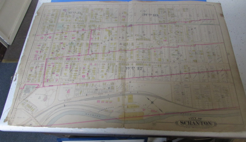
1898 SCRANTON PA - (WARD 9,10,17 ) - ATLAS PLATE 3 - GREAT DOWNTOWN MAP
 Archived listing photo
Auction ended
Final result not shown
Closed
Sat · Jul 18, 2026
Auction window
See it on eBay
Past North America Maps auctions
This auction has ended. The link opens the listing on eBay, where the seller may relist or offer similar items.
Ships from
ZIP 185**
kosloski2005
14,347 ratings · 100.00% positive
Description
From the sellerYou are bidding on this original Scranton Pa Atlas Plate #3. This is a plate of Scranton Pa. It measures 32 x 22 inches and is canvas backed. this plate number 3 Shows these sections of Scranton Pa (WARD 9,10,17) including Pine on the top, Linden & Roaring Brook on the bottom, Jefferson Ave to the Left and Colfax Ave to the right. Great Antique Scranton Map includes: Lackawanna Iron & Steel Co (Iron Furnaces) the property of W.W. Scranton, First ME Church, The Archibald Estate, William Connell Estate and more It is believed to be published 1898. Looks fantatsic. Would look great framed. MAkes an excellent addition to any collection.
Description is reproduced verbatim from the eBay listing. NightBids does not edit seller copy — refer to the live listing for authoritative details, shipping rates and return policy.